GPS Data Analytics

Data Processing

Integration of real world data plays a key role in our traffic simulation. To this end, we use connected car GPS data from Wejo for a variety of purposes. Raw GPS data is ingested and processed through our data processing pipeline. 

We use the processed GPS data for many applications such as destination determination,  traffic regulator detection, simulation validation, traffic forecasting etc.

work trip density profile for a region in sunnyvale

Destination Determination

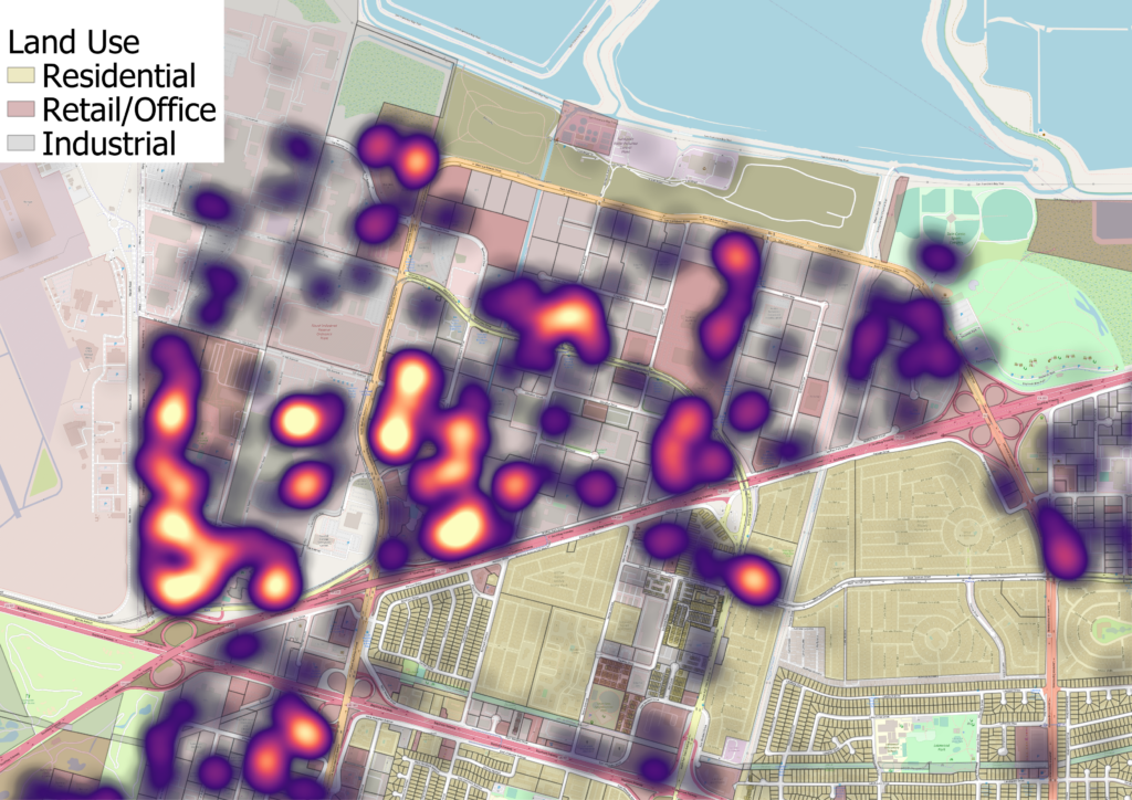
From the GPS data, we can  see where the connected vehicle trips start and end down to the block level. This allows us to determine demand trends at a higher resolution than typically present in most travel demand levels, which can allow us to more intelligently distribute vehicle trips across our network. 

Additionally, we use machine learning to determine the most likely purposes for each trip, deepening our understanding of travel trends. In the figure, Wejo trips that were tagged as ‘work’ in the vicinity of Google’s Sunnyvale CA campus are shown, illustrating the exact spots in this neighborhood with the greatest demand.

connected car data mean travel time to a zone in san jose

Average Travel Times

At a more zoomed out level, the Wejo data also gives us average travel times between different areas. 

As an example, the figure displays average travel times  dervied by Wejo from downtown San Jose to various traffic analysis zones through the region. These real world travel times can then be compared to the travel times within our simulation, allowing us to validate our simulation and fine tune it as needed.

Traffic Signal Detection

By examining patterns in the processed GPS data in where the vehicles stop relative to intersections, and for how long, we can leverage machine learning to determine traffic signal and stop sign locations. Since records of all traffic control devices across a metropolitan area are spotty at best, this step is invaluable in allowing us to add such devices into our simulation model, thereby improving our model’s ability to reflect real world conditions. 

For more details please refer to the paper listed in the publications section.

Scroll to Top